Thank you so much,Arno.
Your advice is really appreciated,and I have to say,I figured this much with state of the huts.
We are really looking forward to it.

Thank you so much,Arno.
Your advice is really appreciated,and I have to say,I figured this much with state of the huts.
We are really looking forward to it.
Good day Arno and Willem.Thanks for all your valuable advice on the Cederberg wildernis trail.My husband and I used it to keep our group safe throughout.We were both very excited, and well prepared, physically and mentally.
We have started on the 21st of September 2020 at Kliphuispass campsite, with a group of 11 people, and ended Saturday the 26th of September 2020 at Sanddrif.
Six days of fùn, laughter, sweat and tears.And above all, we had expeŕienced all the seasons in those six days.
Monday to Wednesday were quite hot between those beautiful rock formations and lovely flowers everywhere. Come to think of it, even though the trail has lots of water available from the fresh water streams, we still felt a bit dehydrated at the end of every day.One need to fill up your water supply as often as possible.
The trail was, surprisingly, very clear, even though there are a few turn offs that might get you off track.But we used the Slingsby map and saved the coordinates on the GPS, so the trail was relatively easy to follow.It is also not marked with a footprint or arrows to follow.
We did not reach Crystal pools hut in time on day three, since there were quite a few up and downhills and every person’s pace dìffers.So we picthed tents at the waterholes (swemgat on Slingsby Map) about three km from the hut at about five 'o clock that afternoon.
The next day to Sleeppad hut was only 4.8km, but we still had to do the 3km that we diď not complete thè previous day.There is a very steep uphill to conquer before one gets to the top of the mountain near Sneeukop.Once on top, ýou are rewarded with a beautiful view and lanscape.
We reached Sleeppad hut early, and could use the time to chill, take a refreshing bath in the icy cold river and water falls just below the hut.
Then the real fun started.Just before sunset, the wind started to blow, and one could see the clouds and mist coming in over the mountains from the southern side.The clouds became so thick, and it crossed my mind, that it is a possible sign of snow.
It started to rain during the night, and the following mòrning the mist and rain were so dense, that one could not see a few metres in front of you.Our group were supposed to go to the Wolfberg Arch that day, but we decided it might be too slippery and dangerous.So we stayed in the hut.
The rain and heavy mist continues to fall during that day, and there were a lot of hikers from different groups and directions coming to the hut for shelter, soaking wet, and cold.Pitching tent was not an option.
During the evening we were 19 hikers crammed in the two parts of the hut.Then, during the night snow started to fall.It was quite cold.
At six the Saturday morning we had to start walking to finish the hike, but the snow fall was still too heavy. A beautiful sight to see, and it looks like a landscape from a fairy tale.Everything was covered in snow.
At 10:30 we decided to walk out on the jeeptrack all the way to Sanddrif, another 20km to go. We pushed through, and snow was still falling on our faces when we started to hike.An awsome feeling and expeŕence.On route we met another gròup that slept in the cave, a few kilometers from the hut.
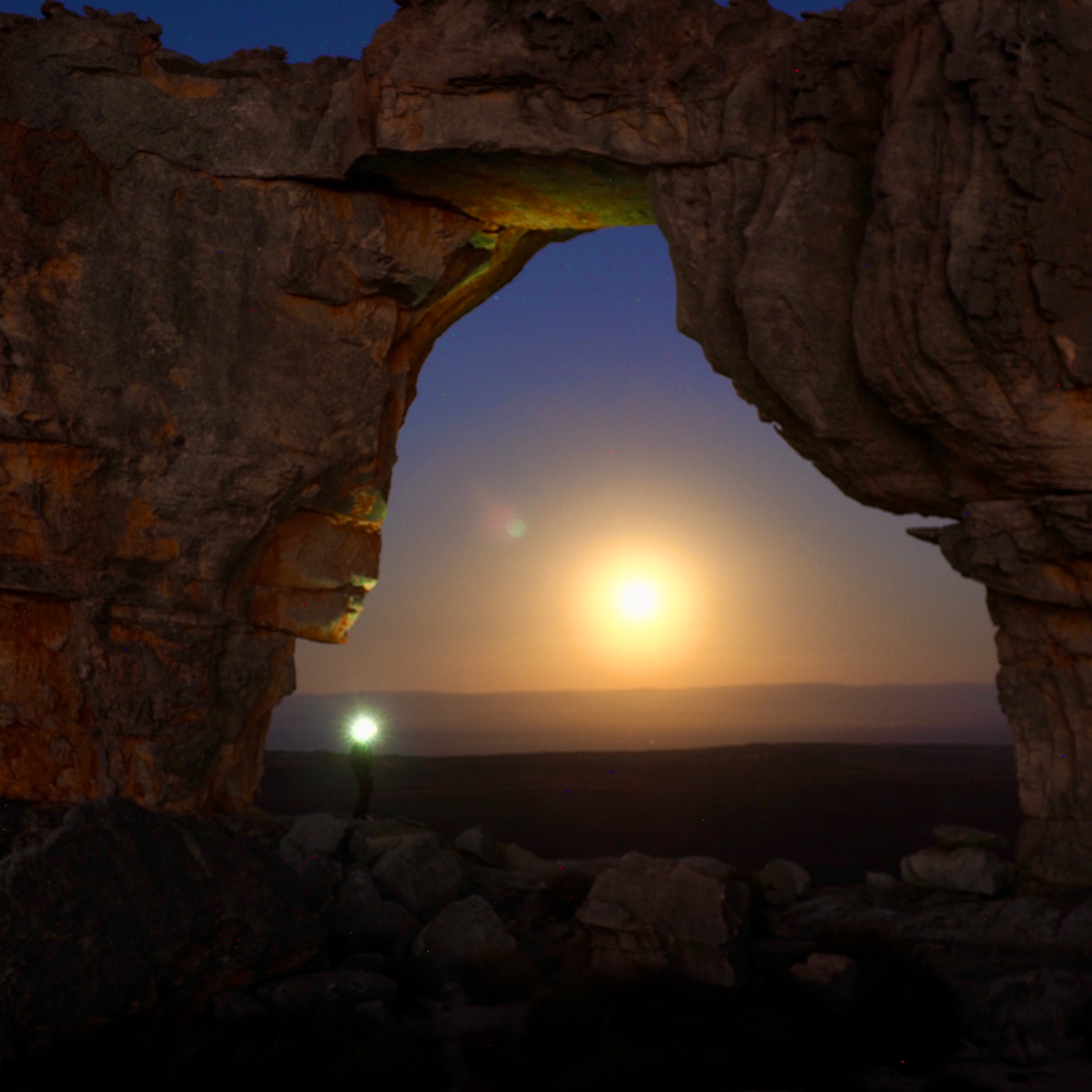
It was an unforgetable experience, and our group were great.We missed the arch and cracks, due to the bad wheather, but the groups safety was our main priority. That will be another weekend hike to loòk forward to.
Ps…huts are still just the structure with straw on the floor, so one should be self sufficient with own tents.But with the heavy wind and rain, it is a shelter that was much appreciated by every body.
Thanks for the lovely write up Annette! I have hiked many times in the Cederberg but never in the snow - count yourselves lucky! Pity about missing out on the Wolfberg Arch and Cracks but ow you have good reason to come back 
What a lekker adventure! Thanks for sharing Annette!
Morning, does anyone have gpx files to share for this route mentioned?
One of us has a new Garmin watch and hopes to play with it. I have the Slingsby paper map so this request is more a ‘want to have’ than ‘need to have’.
Our alternative route is the one this thread is dedicated to, the “Central Cederberg Circuit”. So, again, same request…gpx files, would be most appreciated.
Thanks
p.s. We’ve been perusing “Alltrails”, lots of bits and bobs, hoping someone has the whole route or sizable chunks thereof.
I figured I’d chip in seeing as you’re coming out from Europe:
Its going to be very very hot and dry during December there may not be much standing water, so prepare accordingly, also the guys at Sanddrift dont know the reality of water availability on the mountain dont believe them.
Wolfberg Arch is open and it is gorgeous.
if you’re taking a big pack, the Narrow cracks are quite hassle to get through, particularly if there is a big group ahead of you.
I was looking at the write you you were reading and wondered if you’d taken into consideration the temperatures for these hikes, they sound much easier on the internet than they are in reality, particularly mid summer. Just a cautionary note!
Down the road from Hermanus is Kleinmond, theres some pristine fynbos hiking there too in the Koegelberg mountains, and theres usually water available in the palmist river.
Definitely get the Slingsby map of the Cederberg (not the touring one, or maybe get that as well)
Hi @Carl I don’t have exact GPX files but most of the tracks are on openstreetmaps and opencyclemaps. I find the easiest way is to use Caltopo. Create a free account, then change the base layer to open street maps (I like to put a low transparency topo under it as well). You can then use the line tool to lay out the hike using you4r slingsby as a reference. Also add points of interest with the marker tool. Line tool in it is great as it sticks to routes.
Once you are done with it you can get elevation maps and details under bulk ops on the left. You should be able to export whatever you want to GPX.
Thanks Jaxz. I’ll see if one of us chimps can make this work. 
Looking to be a chilly one I reckon, if “now’s” anything to go by.
I don’t have gpx files for the trail, but that combination of trails (and many others) is clearly indicated on OpenTopoMaps: OpenTopoMap - Topographische Karten aus OpenStreetMap
and if you have an Android phone, you use opentopomaps in the the All-in-One Maps app. Save the area you’re going to walk in, for offline access, and voila!